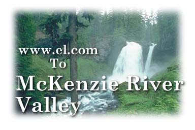
To get to the McKenzie Highway (Oregon 126), take I-105 east from I-5 near Eugene. At the end of the interstate near the outskirts of Springfield, take a left. This will put you on the McKenzie River Highway. This highway is one of the most scenic drives in Oregon, and well worth taking.
Hendricks Bridge in 1908 was the longest covered bridge in Oregon. Although reconstructed twice, it was never covered again. (milepost 11.4)
Hendricks Wayside Park is 17 acres of riverside land with a boat landing, picnic sites, swimming site and flush toilets. It is a day use area with a parking fee of $3.00 (as of Oct. 95). (milepost 11.6)
The Walterville community offers the only shopping center in the valley. It includes a restaurant, video store, grocery store, beauty shop, post office and a feed and tackle store. Down the road is the Walterville Pond on the E.W.E.B. Canal, which is a good spot to catch bass. (milepost 12.5)
Deerhorn Park has a boat landing, toilets, picnic tables and a great swimming hole (milepost 18).
Not far from Deerhorn Park is the McKenzie River Golf Club. This 9 hole course is located on the banks of the McKenzie River.
Leaburg School was built in 1923. A public library occupies part of the school house.
At the east end of Greenwood Drive stands the Ward/Currie house which served as a stage stop for many years.
Leaburg has a community center, veterinarian, auto repair, hair salon, gas/grocery store, motel, fire station, and an art gallery (milepost 20.1).
The McKenzie River Salmon Hatchery is State run with guided tours by appointment (milepost 22.5).
Leaburg Dam offers views of salmon and steelhead climbing a fish ladder. Leaburg Lake is about 40 acres and motorized craft are allowed. The trout hatchery is open to the public and features ponds with albino cutthroat, Columbia River sturgeon and Atlantic salmon.
The 55 acre E.W.E.B. park has facilities for groups up to 600 (reservations required). It is only open during the daylight hours and features picnic sites overlooking the McKenzie River, electric covered cooking centers, outdoor firewood grills, a softball field, volleyball court, horseshoe pits, boat landings, trails and swings for children. (milepost 23.5)
The Old McKenzie Trout Hatchery built near the turn of the century is the new home of the McKenzie River Chamber of Commerce. The main house is a fascimile of a 1900's Sears and Roebuck catalog house. (milepost 23.7)
Good Pasture covered bridge was built in 1938 and is 165 feet long, making it the second largest in Lane County (milepost 26.2).
This community offers a dinner house, liquor store/gift shop, gas/grocery store, cafe, real estate offices and a fire station. Vida was settled in 1868. The red barn to the east of the community used to be the Gate Creek Ranch and Stage Stop (milepost 26.9).
Ben and Kay Dorris State Park offers picnic sites, boat landing and public toilets on this 79 acres of McKenzie River frontage. The park is day use only. (milepost 29.8)
This community was settled in the 1800s. It is home to the McKenzie School, Blue River Ranger District, Blue River Park, a library, two grocery stores, a cafe, an auto repair shop, laundromat, medical clinic and a fire department.
On the Blue River Road #15, there is Mona Campground, the H.J. Andrews Experimental Forest, and Wolf Rock, which is reputed to be the largest monolith in Oregon and the third largest in the world. Another feature is the 1.5 mile Lookout Creek Old-Growth Trail (milepost 44.3).
Aufderheide Drive is one of the McKenzie River Valley's two National Scenic Byways. You will drive through 500 year old trees, nearly 250 feet tall. Visit the viewpoint of 452 foot Cougar Dam. Further along is Terwilliger Hot Springs, with five pools. After crossing the West End Bridge, you will travel past the French Pete Wilderness Area. Permits are required to visit this area and can be obtained at the ranger stations. Eventually the road leads to the cities of Westfir and Oakridge (milepost 45.9).
This community is home to the Log Cabin Inn, a historic hotel/stage stop. It was built in 1886, destroyed by fire in 1906 and reopened in 1907. Across from the Inn is Horse Creek Road, which leads up to Wapiti country. Wapati is an Indian word meaning elk. Hiking trails can be accessed from this road. This community also offers a gas/grocery store (last gas station for 50 miles), resorts, real estate office and river guides.
Jenny B. Harris State Park sits on four acres and has trail access to the river, picnic sites and public toilets. This park is for day use only. (milepost 51.6)
The McKenzie Ranger Station was built in 1934. West of the station is the trailhead for the McKenzie River National Recreation Trail (28 miles long). (milepost 52.4)
The McKenzie Pass/Santiam Pass National Scenic Byway is at the junction of Highways 126 and 242. This loop drive covers some of the most scenic areas in Oregon, including the lava rock tower of the Dee Wright Observatory. The Observatory stands on the 5,300 foot peak of the Old McKenzie Pass and affords breathtaking views of Mt. Jefferson, the Three Sisters and Mt. Washington. The loop goes through areas of recent volcanic activity and takes you past many waterfalls, trailheads, campgrounds and scenic sites. The drive can be continued by going 40 miles to the town of Sisters, Oregon.
Send comments/suggestions/additions? Contact us by clicking here. © Copyright 1995-2003, Essentix, Inc., All rights reserved.